Leeds to Saltaire, via the Leeds & Liverpool Canal path. 13.7 miles
 |
| Granary Wharf, Leeds |
 |
| Oddy Locks |
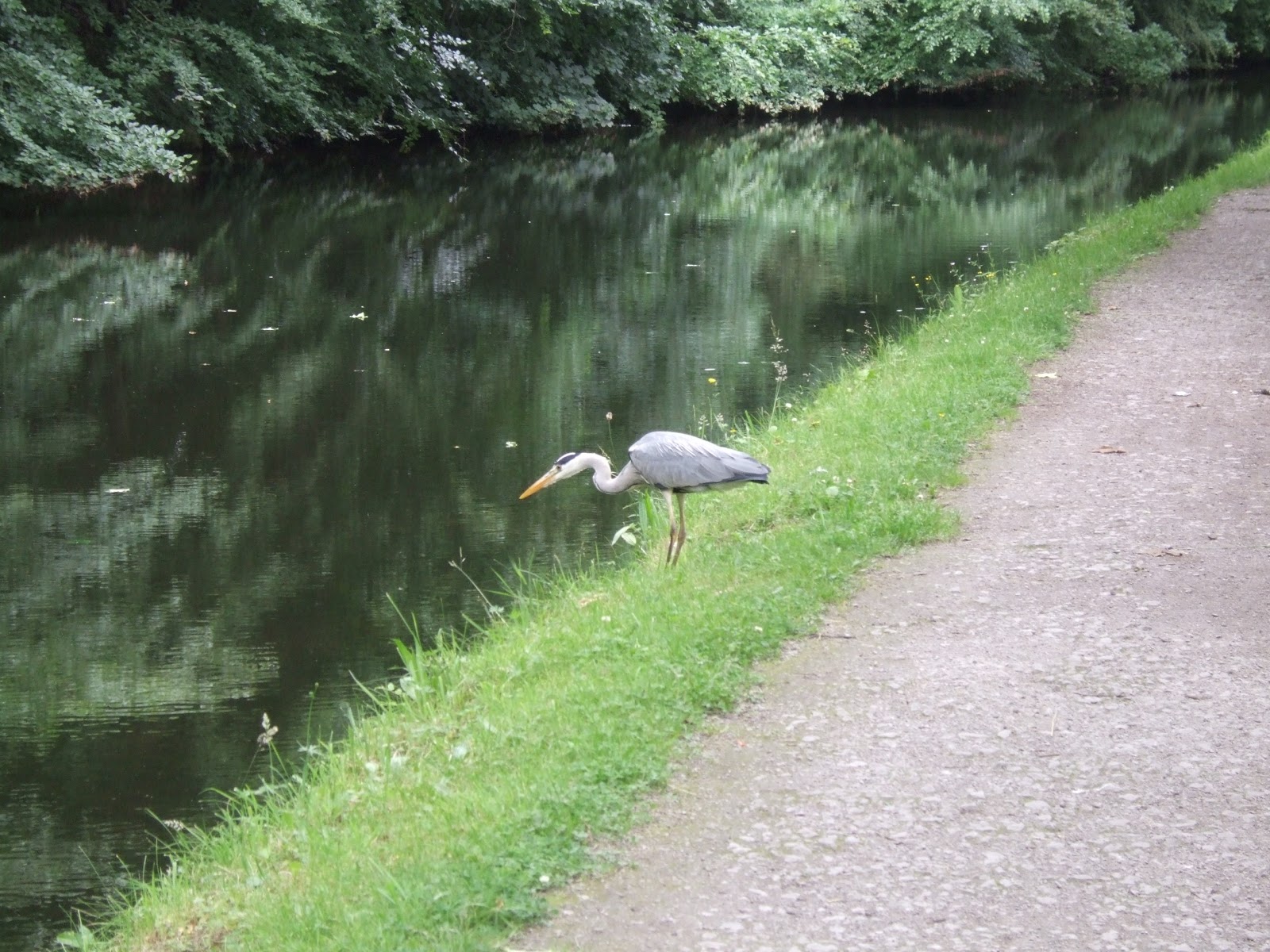 |
| Heron spotting |
Onward under the end of Armley Viaduct (225B) on the Harrogate Line, and at Viaduct Road bridge (225A)a sign has you contorting yourself in an attempt to read it until you realise that its reflection on the water reads 'A remains of a wooden icebreaker lie submerged' and you wonder if it's a warning or a post-modern joke. The canal path isn't the best place to view Armley Mills, but the setting is still aces, with weir of the River Aire in the valley below and the truss bridge (224A) of the Airedale line passing over, and then onward towards Kirkstall, past Aire Valley marina and the west Leeds substation, and slowing to a crawl to get some Heron photography in by Gott's Park, not the largest of its kind but certainly one of the most graceful of birds. Wyther Lane (223) marks the furthest I had ventured along the path, so it's all new beyond there, and beyond Broad Lane (222) we find LMU's Brewery flats, a really nice conversion which must surely spoil students with its quality of accommodation. Under the bridge to Leeds & Bradford Road (221A), and the it feel like countryside all of a sudden, Kirksall Abbey off to the north, Kirkstall Lock on the canal and fields on both sides of it, also Canada geese, out in force. On to Forge Locks, the first Three-Rise on the canal, and its a good one to spot when travelling on the train up the Aire Valley, and also look over the river to the site of Kirkstall forge, which was in continuous industrial use for 800 years until economics finally caught up with it in 2003. Only half a mile distant is the Three-Rise at Newlay Locks and that's a spot to stop for drinks too as I can watch men working the locks as they pilot their boat upstream.
 |
| Kirkstall Brewery Flats |
 |
| Newlay Locks |
From Pollard Lane (221) the canal starts southward, as it takes its cues from the twists of the river, and past Fallwood marina and the immensely desirable Maltings cottage, and carrying on into Rodley, you notice just how much effort has been put into making the Aire Valley green-space as useful as possible. Plenty of canal-side development and nature trails around these parts, as well as looking over towards Horsforth to pick Hunger Hill out of the landscape. Start north-west again and pass Rodley Marina, and there are a lot of folks out here having a stroll with dogs and prams, and Horsforth New Road bridge (215A) marks the Ring Road and the real start out into the countryside, and then the long stretch to Apperley Bridge starts out, noting the fishermen in the shade of Lodge Wood, and wondering who is responsible for the sunken boats abandoned in the canals shallows. Counting the mile posts starts to get difficult as I convince myself that some must be missing, but spotting a familiar chimney, then viaduct and finally playing field means that we are nearly at Apperley Bridge and the canal side under Calverley Cutting Bridge (214B) looks just as good from below as it did when I crossed in on the Leeds Country Way. Plan for lunch somewhere around here, but can't get at the benches at Apperley Bridge Marina as I'm on the wrong side of the canal, but it does have a nice mill conversion and a refuelling station! Press on to Apperley Road swing bridge (214) and then stop for lunch at Dobson Locks Two-Rise, which seems to have one of the still-active canal offices in the associated buildings and you can pause to see just how badly the locks leak as water pours out of the stonework.
 |
| Apperley Bridge |
 |
| Dobson Locks |
The sunny weather of the morning feels like it has passed as we go under the railway again as to cross at the perpendicular (212A) and north we go as the canal continues to parallel the river, and the first time it starts to feel quite remote from civilisation, even though we are actually in the midst of sewage treatment facilities. Retreat under trees at Field Locks Two-Rise as it starts to rain heavily but briefly, and observe the outsize truss bridge above the lock (211A) really is a bridge to nowhere, if maps are to be believed. Then another long drag down towards Shipley, another oddly de-populated stretch, and I can look up towards Baildon and the exposed rock of Baildon Bank, which the town seem to have surrounded, it makes me wonder why towns encroach onto moorland and run the risk of rockfalls into the gardens of the unlucky residents. Looking towards Shipley Parish church, I note the sky starting to grey out, and when the church vanishes I realise that a huge rainstorm is about to tear down the valley and I pick up the pace to try to get to the Railway Bridge on the Baildon Line (210A) before I get soaked. I fail by about 100 yards and loiter for a while after putting on my waterproofs before deciding that it's not going to get better any time soon and then pressing on. My top half was protected by my fleece but my trousers are soaked, so I decide that Saltaire will be my finish point when I had considered pushing on to Bingley.
 |
| Bridge 210A, Shipley |
 |
| Salt's Mill & New Mill, Saltaire |
Squelch into Shipley past the stump of the Bradford Canal and several housing developments which I had considered when looking for somewhere to live back in 2007, and pass under Otley Road bridge (207C) to wonder if the Last Supper parody mural is public art or surreal graffiti, and than on to see that Shipley is a town that has loved its mills and even had new development designed to fit in with warehouse and wharves. Just beyond the 13 (and a quarter) milepost, the weather suddenly eases off and the sun roars back out as the canal meets its most attractive industrial sight of the day as it passes between Salt's Mill and New Mill at Saltaire (the largest industrial buildings by floor area in the world when completed in 1853), towering 4 and 6 storeys high in yellow sandstone with Italianate stylings and campanile style chimneys, a wondrous sight to end the day as I'm too wet to continue. Bridge 207A can be my end point and I can end my solitary day at 2.45pm and join the throng of people who are out to enjoy Titus Salt's model town and West Yorkshire's UNESCO World Heritage Site. It's still a place I need to visit properly, but whilst I'm walking there probably won't be time for that, maybe when I start my architectural blog in the future? Yeah, maybe.
1,000 Miles Cumulative Total: 221.9 miles
No comments:
Post a Comment