The London & North Western Railway were late arrivals to the Peak District, a region dominated by the Midland Railway (of whom more later), and their line from Uttoxeter to Buxton (via the lines of the North Staffordshire and the Cromford & High Peak railway) was opened in 1899 in an attempt to generate revenue in the area and to milk some of that sweet tourist money. It was a line that was popular with ramblers for easily accessing Dovedale and brought visitors to the Tissington Well-Dressing Festival (when people used to travel for such things), but the line was never profitable and only the lower section below Ashbourne was any use for local traffic and it lost passenger services in 1954 and closed entirely in 1967. The track bed north of Ashbourne was acquired by Derbyshire County Council and in 1971 was opened as a dedicated cyclepath, one of the first in the whole country, and as it's the longest of my planned walks for this holiday, it's a good idea to get it off the slate nice and early.
The Tissington Trail: Ashbourne to Parsley Hay. 13.5 miles
 |
| Ashbourne Tunnel |
My parents drop me off at the car park of Ashbourne Leisure Centre at 9.35am, and a keen eye can spot the indication that this was the site of Ashbourne Railway station, and the trail goes north from here, and you've only crossed one stream and gone under one bridge before you are presented with the engineering gem of the whole trail, namely Ashbourne Tunnel. Brick built and lined and a modest 350 metres long, and dead straight and well lit, but enough for it to be fiendishly cold in the middle, and the sound installation of the sounds of passing steam trains is a slightly disconcerting experience. Be grateful for the good people of Sustrans for getting this reopened back in 2000, as the walker can now emerge into the countryside by Mapleton Road having walked under the north west corner of Ashbourne and beyond the Tissington Trail proper starts up and leads past the cycle hire store and off uphill into the Peak District. It's only a quarter mile out that we meet the site of the only notable casualty on the trail as the path dips sharply downward to cross Bentley Brook before ascending again just as sharply, this was the site of the seven-arched Ashbourne Viaduct, a structure so forgotten about that I can't even find a picture of it.
 |
| Fenny Bentley Cutting |
Hopes for a nice day for walking have been dashed as the weather forecasts low clouds and mist for the whole day, and a sharp wind blows consistently from the east, but under the cover of trees as the path hugs the contour along the hillside, I have at least gotten enough shelter to not need to add extra layers. I'd hoped for a bit more of a riot of autumnal colours to go with this week, but it's mostly greens and yellows on the trees and the leaves have fallen without having ever taken that Autumnal hue. Seclusion under the trees is the tale for most of the early going, wondering if there are only four other people out on the trail, and only getting occasional views out to nearby farms along the way to the first former station on the line at Thorpe Cloud. A change of landscape comes as you enter Fenny Bentley cutting, apparently a site of special scientific interest for those interested in such things, but it's more of an impressively deep and wide railway cutting to me, one with a very nice double arched bridge at the end of it too. Glad to see more folks out on the trail, so I know I'm not completely alone, and after crossing the A515 on a bridge that is oddly identical to the one on the Spen Valley Greenway at Ravensthorpe, it's on into a familiar landscape of seclusion under trees with looks out into the farmland as it rolls on by.
 |
| Tissington Station |
Arrive at the site of Tissington station, and stop for a watering break, and enjoy the fact that it still has intact platforms and gradient indicator, though the signals installed are obviously not original. I intend to seek out further bits of railway ephemera as we go along, and open an eager eye as we set off into yet another wooded groove as the line describes a broad curve as we continue north. A few more overbridges come along in this section, and one still has the remains of telegraph insulators on it, not the best bit of railway ephemera but it is a start. Occasional views out indicate subtle changes in the landscape as the hills start to roll a bit more and the fields enlarge slightly and the vegetation becomes a bit more sparse, and when the path moves into an exposed section or two, the wind whips in wickedly and the weather shows no sign of improvement. A feature I immediately love about this limestone country is when the line digs into a roll of raised land, it appears that it should go into a tunnel, but instead a deep and sheer sided cutting is carved down into it to accommodate the line, so unexpected and quite wonderful and as the terrain gets rougher, every cutting forms like it. Have an odd moment of hearing voices on the line, until you realise that sound travels a long way out in the open countryside with only the wind and the A515 to otherwise obscure it, and there's a surprisingly large amount of cyclists and walking along the way as we drag into Alsop en le Dale station. Stop here for lunch and disappointingly rate Waitrose's pizza as being much worse than Morrisons's.
 |
| 'Next Stop: THE END OF THE WORLD' |
 |
| Alsop Moor Cutting |
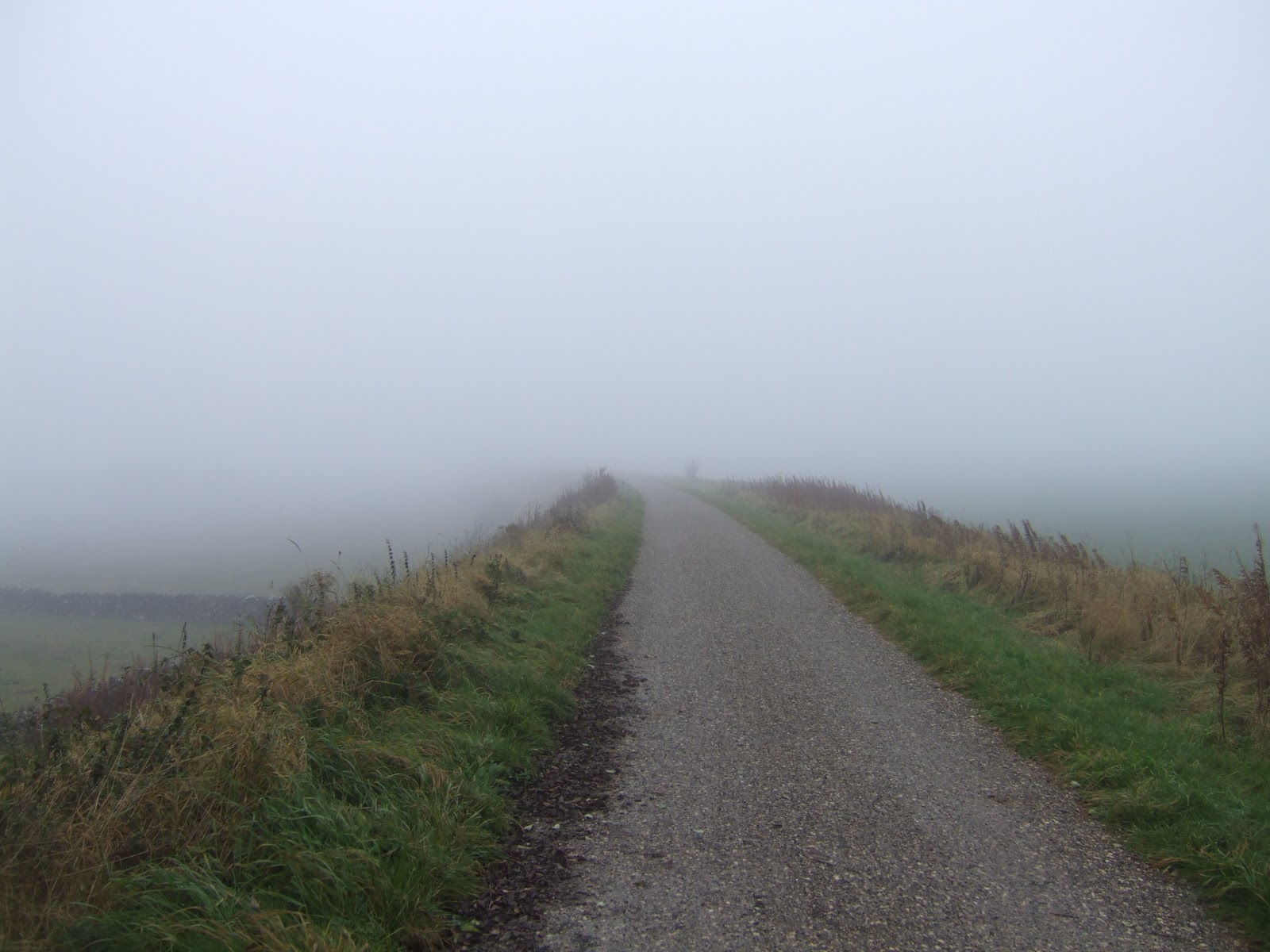
Alsop village is hilariously difficult to get to from the station, but we stay to the firm trail and the signage tells us that we've 7 miles to go, and my route map indicates little to note until Hartington, 5 miles distant, and as the route wanders between opposite sides of OL24, map reading isn't going to help all that much. I know i can't get lost though and head off, under the short tunnel that carries the A515 away from us. The first exposed section indicates that we are heading into the high moors as the lack of cover has the wind stinging us hard, and where we should have a view down into the fringes of Dovedale, we instead see mostly mist, which has either descended upon us or we've walked up into it. Gaining shelter is welcome after that, and Alsop moor cutting is another long and deep cleft in the landscape and it's positively cosy compared to the open stretches, but dripping with atmosphere and might be my all-time favourite cutting! The open sections beyond are just awful and for the first time, the horizon disappears in the mist and from the embankment it appears that the next stop is 'The End of the World'!, I meet multiple groups of kids, all wondering why the chose today to do their Duke of Edinburgh's award, and I'm damn glad that I've got an obvious path to follow and am not out on the open moors. Pause at the Biggin Road bridge to photograph another gradient marker and a large group of kids cycle south past me, and I note that all the folk I've seen are going south, I start to feel like they are the wise souls as I plough on north, into the moorland and mist.
 |
| Hartington Signal Box |
More open sections follow, with farmsteads peeking out of the mist atmospherically, and a track side marke indicates '3', but I'm not sure which three miles it might be indicating as distance has little meaning in this weather, and I press on as the terrain shows rough rocky outcrops, numerous sheep pens and what might be antiquities, whilst the path offers us some poetry for those so inclined. When signage indicates we are passing Ruby Wood, I feel happy to have a sense of where I am again, and the following cutting lands us at Hartington station, where a restroom break is much needed, and they've a good few bits of ephemera left, notably the signal box which is still intact, complete with frame and stove and would be a pleasant shelter, if it were open. Cross Hartington Road bridge and see my last soul out on the moors for the day, and pass through two more cuttings before the path actually feels a bit precarious as it passes above Hartington Moor farm. The cold and mist has now started to feel penetrating and when I find a plate-layer's hut, I retreat inside to don the extra layer that I thought I could do without, and as I psyche up for the last stretch, I think it has started to rain until I find that it is just water running off the tree outside.
 |
| Parsley Hay |
Press on through one last deep cutting before the sound of the A515 is heard once again, and a familiar sort of land configuration moves towards us from the right meaning that we are arriving at the junction of the Cromford & High Peak railway, nowadays known as the High Peak Trail and not on my walking slate for the week as it is just a bit too long at 17 miles. Not sure if the Tissington Trail ends here, or a bit further along at Parsley Hay, the very definition of the railway junction station in the middle of nowhere, and this is where today will end, finding that the cafe is closed and the bicycle shop is not exactly overwhelmed with custom. Check my watch to see if I kept to schedule, and it's 2.50pm, a whole 10 minutes ahead of my planned arrival time, and sure enough my parents arrive on cue to take me away, and we head back to base southwards, deciding that an extra 20 miles on the roads to go visit Buxton probably isn't worth it in this weather.
1,000 Miles Cumulative Total: 416.1 miles


No comments:
Post a Comment