 |
| Self in Ilkley |
Backpacking is not my thing, I'm very much a one-day-at-a-time walker, but when it came to examining ways of assaulting the Dales Way, I couldn't theorise a better way of taking on the first three stages up Wharfedale, the only alternative would be many hours of travelling on Dalesbuses up and down the valley, and that would be a lot of day wasted just going hither and thither. Anyway, Spring is due to start and I need to take a break away, so book rooms in Grassington and Buckden and pack your life into a bag for three days and get going! Trouble is, my regular bag isn't really big enough, so I have to score a bargain at Nevisport and get myself a new 35 litre rucksack, and when that's loaded up with 8 kilos of gear it feels like a weight that I have only carried as far as the railway station in the past. But onward to the Dales Way, to make serious inroads into my Walk to Windermere, and I've no real idea of how far it is to Bowness as my route guide says 78.7 miles, wikipedia counts 84 and the sign at Ilkley Old Bridge claims 82. All I now is that if I'm going to be carrying 8kg of my belongings with me, I am going to count every footfall towards my walking total, and with a 17 mile opening day and the promise of a blast of arctic weather on subsequent days, the greatest immediate risk to my progress is me psyching myself out, so let's get on the move!
Walking to Windermere: The Dales Way #1: Ilkley to Grassington. 17.1 miles.
 |
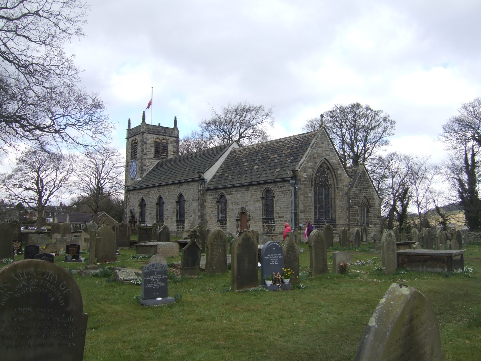
| St Peter's, Addingham |
Depart Ilkley railway station at 9.35am and take a wander down past All Saints and Ilkley Manor to reach Old Bridge for a 9.50am start, and there are plenty of people wandering about under the first rays of spring sunshine until I want someone to take my picture at the Dales Way seat, so I have to photograph my bag, stick and shadow myself and then move on along the path beside the south bank of the Wharfe, which will be keeping me company for most of today, and settling into the idea of carrying a heavy load as I go. This leads to the drive way to Ilkley Lawn Tennis and Squash club, and then strike out over three fields to observe snow aplenty on the high lands of Addingham moor and steel myself to the idea of snow on the high grounds in the coming days, and then we hit the banks of the Wharfe again, opposite Ilkley Golf course, and the idea of following a level riverside path disappears as a sharp up-and-down is traversed before crossing the pasture which leads out to Ilkley Old Road, the former route of the A65, which roars away beyond the trees. Road walk, teased by the thought that Addingham is a lot closer in my mind than it is in reality, and the path leads down Old Lane to the redevelopment at Low Mill, I don't go such a bundle on the newer builds but the old houses are definitely some des-reses.Follow Low Mill Lane as it leads into the bottom corner of Addingham, and see that the Old Rectory is one of the more outsized ecclesiastical buildings encountered in an out of the way place, and the path drops us down to lead us round the perimeter of the churchyard of St Peter's, but I'll take a stroll through the graveyard as I have no qualms about deviating from the path (the Leeds Country Way had no problem with crossing church grounds, after all) and this church is apparently notable in Yorkshire for its blue clock face, which happen to be ten-a-penny in Leicestershire, where I grew up. The path leads us on through the ginnel onto North Lane, and I note just how expensive Addingham looks, recalling that one of my colleagues retired here a few years ago and I still wonder how she managed to do that on a hospital worker's salary, I assumed she must have been running guns as a sideline.
 |
| Low Park |
Depart Addingham down to Wharfe-side again, ignoring the path over the suspension bridge that leads towards Beamsley Beacon, the southernmost of the Dales hills, and looking snow-capped and appealing today, and follow the riverside on to High Mill, where a much needed watering break is taken. Onward for a detour through Olicana Caravan site, with associated shudders at the thought of caravanning, before returning to the riverbank for another stretch featuring a sharp ascent up the bank followed by an even steeper descent to return in the picturesque setting of Low Park. Crossing the various fields, the weight starts to feel heavy on my shoulders, and crossing various stiles has my mind starting to think that this was a bad idea as my balance wavers and ankles start to feel it. Having no real idea where I am adds to the feeling of dislocation, and ascending from the river bank to cross Bolton Road, brings us up to a circuit around Fairfield Friends Meeting House and then it's over various styles and the access road to Fairfield Farm and Livery to meet the permissive path which allows us to make progress north without running the risks of getting mown down on the B6160. The uneven surface and general muddiness are only slightly preferable to road walking, and after too much slithering and squelching, my brain wants to go home again, but just as I risk psyching myself out, we meet the road and get a view of Bolton Priory in the distance, and now that I have a visible target, and a known distance on the ground, many of the aches and worries pass and progress down to the A59 is made with lighter steps.
 |
| Bolton Priory |
Pass off the road, under the A59 bridge, the last major road we will be seeing for a long time on this trail, and come up to the packhorse styled Bolton Bridge, looking much of a vintage as Ilkley Old Bridge, and this marks our entrance into the Yorkshire Dales National Park, as well as to the Bolton Abbey estate. The day is chilling slightly and I've got a sweat on, so pick up the pace along the path which leads over the neatly manicured pasture, tended by many sheep, and I've always liked the Bolton Abbey estate, as the Devonshires have pretty much created what a privately owned estate accessible to the public should be about, they are probably the most socially aware of all of Britain's noble families. So roll up to Bolton Priory, established in 1120 and dissolved in 1539, and home to the full range of ecclesiastical styles, and also one of the more confusing names for it was only ever a priory in its lifetime, but has been mis-named for over a century now. Cross over the Wharfe at Waterfall Bridge, admiring the landslip on the north bank, and pause by the beach for more watering, a beach which I visited some tome in the 1970s but still don't recall as not being a seaside trip. Then strike off across the pasture again, taking our last look back to Addingham Moor in the distance, and once that disappears from view, I feel that Lower Wharfedale has been left behind, though where the boundary actually is located is a point of some conjecture. Anyway, there are now relative crowds of people out on the paths after 6 miles of solitary trudging, and the path rises and falls sharply as it passes through the wooded side of the river, it's certainly not the sort of path that I'd take toddlers out on as they master their first bikes. Pass the money tree, a fallen log with many coins hammered into it, and eventually descend to Storiths Lane and avoid the ford over Pickle Beck, and then it's onto pasture for the stretch up to the wooden bridge which crosses over the river to wind us up at Cavendish pavilion, a place for a necessary rest stop and lunchtime, but having not cooled down too badly, there's no immediate need for a revivifying pot of tea.
 |
| The Strid |
Then press on into Strid Wood, as the riverbanks take on a wilder aspect, but the path presents a decent road surface to pound as the river runs down through the gouge between two gritstone uplands and again the paths are busy, including one couple who are only too happy to banter about how much they love holidaying in Wharfedale and pass on pointers of what to look out for as I carry on to Grassington. Did you know that the Bolton Abbey estate used to belong to the Cliffords? Earls of Skipton and dominant figures of the landscape all over the Dales and the Eden Valley, who have been encountered on several of my walks but oddly not mentioned as much as I'd thought in my scribblings. There's plenty of fun to be had in this woodland, and I especially like the woodcarver's stall, set out to produce whatever bit of rough garden furniture you might want as you watch, and eventually we arrive at the Strid, the narrow and turbulent channel where the river carves down through the gritstone, presenting what looks an easily makeable jump, but is in reality wider than it looks and is also apparently some 9 metres deep. It's not looking as ferocious as it did last time I was here, so I feel no fear in striding down to the edge to admire the river carved rock forms and the deep impressions caused by water and small stones scouring the rock in times of inundation. Depart on the rising path as it gets rougher underfoot and gradually the woodland thins down as the edge of Strid Wood is met and the open countryside offers a view up to Barden Tower, a former hunting lodge, built by the Cliffords, natch. The path leads us to Barden Aqueduct, an eccentrically battlemented structure which still carries water from Nidderdale to Bradford, and cross over to the north bank again, and then press on to Barden Bridge, another packhorse bridge out of the late 17th century pattern book.
 |
| Simon's Seat & Carncliffe Top |
Pause for watering and to change maps (which I have barely consulted), taking stock at the distance covered so far, having topped 10 miles, I feel better that I am well over half way and I look on to the next 7 miles through new territory as Barden Tower was my furthest penetration point into Wharfedale so far. The walkers reduce in number again as I hit a long haul along the river bank and between pastures on both banks and distraction can be had from watching the lambs gambolling in the fields and seeing that Wharfedale's farmsteads have a unique look, quite unlike those on the 'Urban Dales' of the Aire and Calder. Also take looks up to the snow covered hills, but unfamiliarity with the terrain means I'm not entirely sure what I am looking at, and the path goes on to depart the riverbank by two rather unappealing chalets to cross over the in-running Fir Beck, before arriving in some rougher land as the river creates some unphotographable rapids as it passes through Haugh Wood. The path seems to rise to a farm track, where I meet folk making a break for the village of Appletreewick, just off the trail, and I realise I should have cleaved closer to the river bank, so return to the correct route and take a look back to get a good view of the snow capped Simon's Seat and Carncliffe Top, whilst ahead of me Burnsall & Thorpe Fell mark the rough edge of the gritstone uplands north of Skipton, all these highlands are currently walking targets for the future. There's a bit more up and down to be had for the plod levels out again before breaking away across a loop in the river, passing Woodhouse farm and crossing Barbon Beck and then it's back alongside the river to meet the pasture/cricket field/car park down river from Burnsall, and I pause here for refuelling as the better part of the day feels like it has passed, and the sky glums over.
 |
| Loup Scar |
I had considered Burnsall as a stop point if I hadn't felt up to the last stretch to Grassington, but the price of rooms put me off, and so I cross the bridge over to the village, easily the best bridge of the day, and note that the settlement offers an appearance of size, but there isn't much more to it than is immediately visible. Looks like a nice spot though, and file it for a future visit, and hit the path away along the riverbank, which signage indicates is a path with over 1,000 years of usage, and I'm not really certain how you prove such a claim. There's verifiable geological antiquity along here though as the river bank offers much lighter rocks appearing from the river banks and that must mean we have crossed one of the Craven faults without me noticing and we have moved into Limestone country. Soon enough the path rises up and the river grinds its way through the rapids below Loup Scar where a the waters broke through a fault line and despite being thousands of years old, it still looks rough enough to have broken through relatively recently. Continue along the bank for a distance until the last river crossing of the day comes up, passing over Hebden suspension bridge and this isn't one to cross if too portly, or if you have vertigo, or if you suffer motion sickness. Cross that with baby steps and feel relief as the north ban is met, and then press on down a long grassy valley lined with trees, which I'm sure would present a pleasant rural idyll as part of a shorter walk, but at this point in the day it just seems to go on and on and on...
 |
| Grassington Market Place |
The landscape opens out below the battlemented Lythe House farm, and I wonder what might be making the ominous noises coming out of the hut by the riverbank marked 'Keep Out', and strike off over the pasture with the squat and ancient church of St Michael and All Angels, Linton, as a landmark on the south bank, and our route takes us around Brow Well mill, home of the publishers of the Grassington Bay2Bay walks, and then it's back to the riverbed, with the Wharfe's fiercest waterfall making itself apparent in the distance. Linton Falls are massive, but hard to photograph, despite having a footbridge across them, charging over limestone and roaring in a way not heard since Low Force, and I'm intrigued that a relatively new housing development has gone up so close to them, but as this is on the site of Linton Mill, I assume that planning regulations for Brown Field site are much more lax. Carry on past the mill's huge weir and beyond that is the hydroelectric plant which first brought electricity to Grassington, and the route rises away from the river and the bridge running into the town and Station Road is met for the first road walk in an age, and its quite an ascent to finally arrive in the administrative centre of the Yorkshire Dales National Park, and quite the most picturesque limestone town you could want for. Roll up at the market place and check my timekeeping, 4.50pm and 7 hours on the nose from the start of the Dales Way, and with my room at the Black Horse Hotel being just off the next road along, it's only a few more steps to be made to conclude what has been the longest day so far in my walking lifetime.
To Be Continued...
1,000 Miles Cumulative Total: 543 miles
(2013 total: 77.7 miles)


No comments:
Post a Comment