 |
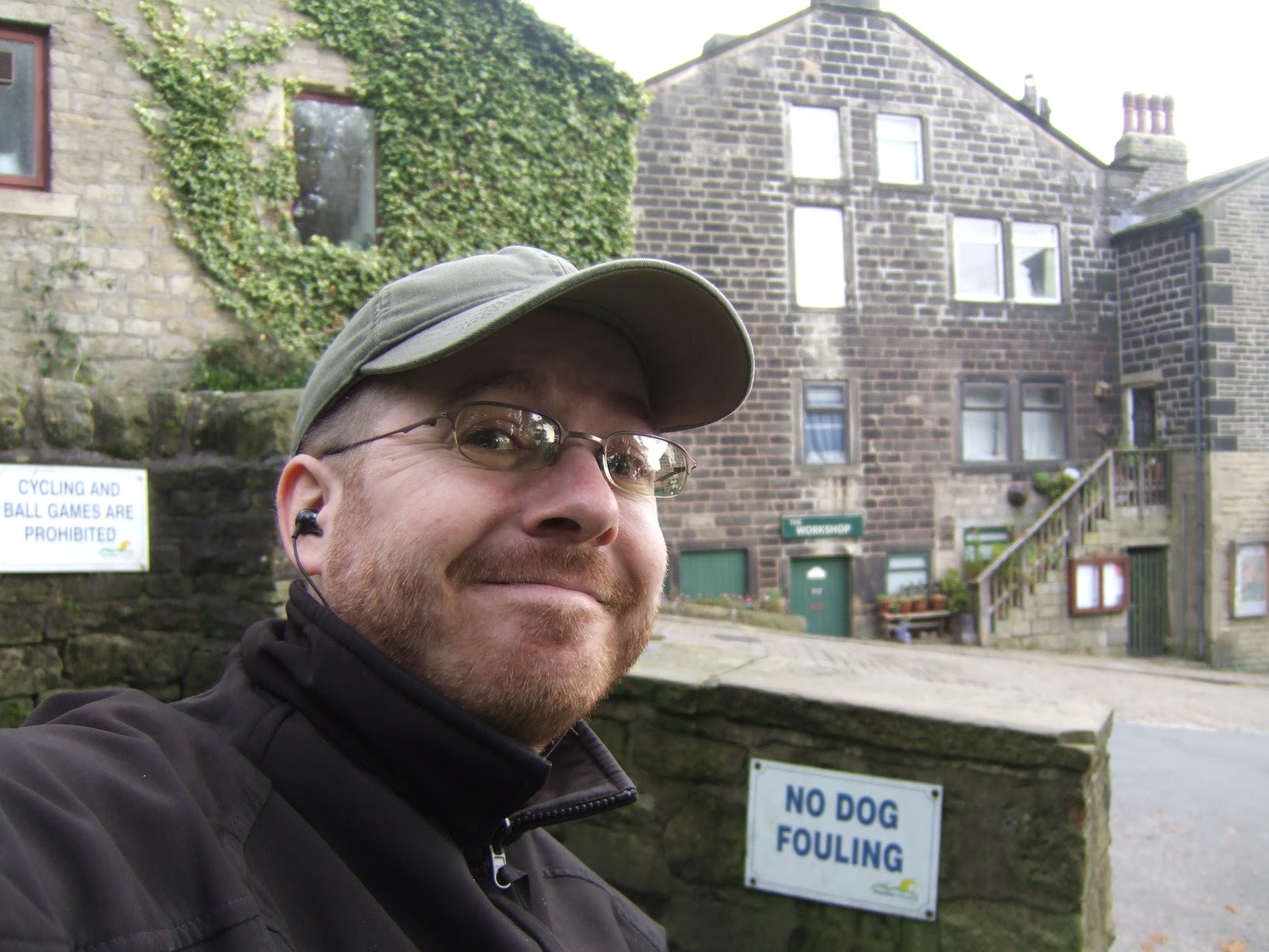
| Self in Heptonstall |
The morning looks like the Autumn might be coming on hard, suggestions of fog up on the hillsides as I ride out into Calderdale, and I wonder if this might be the day when the local weather catches up with me, or maybe the first occasion of getting lost on a misty moor side. Anyway, arrive via the train in Hebden Bridge and there's no way on Earth that I'll be walking up to Heptonstall, as that is one unnecessary ascent too many, and I love the fact that the bus service E, my chariot to the hills, waits at the railway station to check that any passengers wanting the service will have time to catch it. I'm one of two patrons for it, and it's a slow grind up the hill, but still entirely preferable to hoofing it, I do seriously wonder about the walkers that we pass on the way up...
Calderdale Way #4: Heptonstall to Illingworth. 9.6 miles
 |
| Peckett Well Clough |
So, 9.20am and Heptonstall appears deserted aside from walkers trying to find their way out to the Pennine Way, and it's all very atmospheric with the mist hanging in the air, but it gives me a small sense of trepidation to see the high moors a couple of mile distant with white cloud hanging heavily above them. Fortunately, it's going to be a while before I get up there, because the first stretch of the day take us straight out of the north end of Heptonstall and downward, a steady 100 metres of decent over three quarters of a mile to the crossing of Hebden Water at Midgeholes. Having the stick is again useful, picking my way steadily down into the trees and through the mix of cobbles, mulch and dead leaves, and I'm already making mental note to not try the path in reverse as this would be a rotten end to a day's wander. Crossing the river near the entrance to the Hardcastle Crags estate leads us straight to the ascent up the other side of the valley, so it's another three quarter mile trudge, over a slightly more interesting and twisty path, leading up through the National Trust's Peckett Well Clough wood, a fun sort of space littered with gritstone and beech leaves, and once over the beck at the top, it's time to emerge above the tree line to not get the excellent view down Hebden Water that I had anticipated, I guess Colden Clough spoiled my expectations of the views in these parts.
 |
| Wadsworth Moor & Cock Hill |
Cross the A6033 (again) and take the path up onto the higher road of Akroyd Lane, pause for watering and admire the view toward the Smeakin Hill war memorial and wonder just how people might get to it, and look over toward Peckett Well and wonder why the mill doesn't look as familiar and prominent as it does from further down the valley (it's because the mill visible from down the valley isn't the one at Peckett Well, it's Old Town mill that you can see parked on the hillside). There's still another stretch of ascent to come, about 80 metres more, around the Shaw Croft and Slack farm buildings and up a very ill tended path between, and once you reach the high contour, there are still more turns to negotiate and paths to pick out in the rough ground above the Hebden Bridge Equestrian Centre and below Old Hold farm. Finally hit the edge of the moorland of Wadsworth Moor and leave the fields behind, and the cloud has risen enough to offer views towards Stoodley Pike and down into the valley, and also to the promontory of Cock Hill which is our visible destination along this path. So off we go, keeping close to the boundary fence and hugging the 350 metre contour, and it's all a bit of a plod, and the glum skies make the view a bit less impressive than it should be. The loud does break up a bit, which does lift moods a bit as we go, but all the sunshine is falling on the even-higher moors off to the northwest. Cock Hill is met. and disappointment lands on me as I find more high land that has been turned into a Golf course.
 |
| Midgeley Moor |
Take my last looks toward Hebden Bridge district before the path swings us around and onto Midgley Moor, and the views open up towards Cragg Vale and Mytholmroyd, and despite semi-regular ambles around the environs of this town over the years, I've never made it all the way up here, so this is a whole new perspective on this burgh. Crack on through some soft going and disagree with the route directions aiming me towards the only trees on this hillside, choosing correctly to stay above the wall line that leads me up to the standing stone Churn Milk Joan, which is less a megalith and more of a post. The only bench I've seen on this moor is nearby, and I bag that for lunchtime, after the only other walkers that I have seen all day have moved on. Enjoy the emerging sunshine as I eat, and start down the way-markered trod down to the lower boundary of the moorland, but looking back I see the clouds darkening rapidly, and a shower of hailstones indicates that Calderdale's weather has finally caught up with me. I drag on my waterproof top and press on grimly, but the rain just keeps on getting heavier and my trews are already soaked by the time I decide to stop and waterproof my lower half. The only good thing to be said for it is that it isn't terrifyingly cold, but the views down to Sowerby Bridge are lost under sheets of grey and trying to keep my map and route directions dry is a challenge. The hard rain pounds down for about a mile's worth of walking stopping as I reach the end of the moorland and meet the top edge of Luddenden Dean.
 |
| Luddenden Dean |
I don't feel inspired by knowing that I am going to have descend all the way to the bottom of the valley and then head back up the other side, and I can't really pick out my route in the landscape, either. I actually consider bailing until I realise that walking to Sowerby Bridge would be equivalent of about half of the remaining walk, so press on down the hill from High House Lane down to Jerusalem Lane, between various farms and down one particularly horrible field. Moods are lifted by the graffitied hay bales which read '
Kyle Craig Senior is a Monkey', and the path leads into Booth Wood for a bit of a slippery descent down to Wade Bridge over Luddenden Brook. Water again as i psyche myself up for the ascent, and Wade wood seems to offer a riot of paths, and I'm uncertain that I picked the right one until it emerges at the lower edge of the wood as it extends up the hill. The sun is out again, and the view towards the prevailing weather suggests clear skies for a while, so I feel brave enough to shed the waterproofs, and just in time too as I'm starting to sweat like a horse. Then press on up the hill, as the path passes a nice holiday home, a rough looking farm, and the remains of a horse carriage abandoned by the track, makes a change from railway wagons I suppose. Follow the track that leads us Castle Carr Road and from there I can look out over the edge of the moorland and imaginate a more or less straight line run to the finish line.
 |
| Illingworth from Hunter Hill |
It's nothing like that of course, skirting along the edge of Warley Moor is fine until it starts to get dangerously marshy and you have to take great care to keep to the path, which has railway sleepers laid in numerous places for ease of passage. Then beyond Moorfield farm you get another horribly cow-carved field to negotiate and an awful track below a small reservoir, and then from Hoyle Bottom Farm to Hough Gate farm, you get a steep ascent that you just didn't see coming. At the top, I look back to get what I assume is my last look towards Stoodley Pike and from Withens Road, I can see Wainhouse Tower off to the south and the high buildings of Halifax appearing as I move on around the old quarried land atop Hunter Hill. Just as I can point to a white triangular building and say 'that's my destination', the cruelest optical illusion is made apparent and I realise I've got another descent and ascent to go before I'm done. Take a heavy sigh and admire the view towards the wind farm on Ovenden Moor to the north and down to Mixenden Reservoir in the south before taking the rough track down to the very steep field walk off Hunter Hill. Plod on over the fields to go on through Stod Fold farm, home to the only gate that I couldn't open on the whole trail, and press on to Lane Head Lane (!) where the uphill starts again, beneath the rocks of the quarrying on the hill above and ascend until the Croftmount 'Pet Resort' is met and my route hits steps up the hillside. My legs do not want to meet steps right now, but carry on as the path leads us past curious horses and the backs of the buildings of Upper Brockholes and we pop out onto the road by Mount Zion chapel. Carry on along Per lane to where it meets Keighley road, the A629, and that's where we can call time on the walk, not really at any nameable location, but it's 3.40pm and there no chance of a beer at the Moorlands Inn as it's been another long day and I really am a long way from home high up here on the hills above Halifax.
So hit the road down to the Illingworth estate to land the first leg of my trip home, positively exhausted once again, and the conclusion of this trail should come hurrying along next weekend, but poor scheduling means that I've got a week of Autumn Jollies before we get to complete the Calderdale Way, so on to Derbyshire before we can return to the trail once again!
To Be Concluded...
1,000 Miles Cumulative Total: 393 miles


No comments:
Post a Comment