 New Shoes:
 Does anyone else do the skit of discovering that somebody has new footwear and going 'Noo Shoos! Noo Shoos!' repeatedly? I do, and have no idea why! But it's new boots day for me, and having made no attempt of any kind to break them in, let's hope they're not going to rub me up, I'd worried that they might pinch a bit when I bought them, but today they felt a bit on the roomy side, so I hope my feet don't slide all around inside them. They're as comfy as you could want though, and it's going to be nice to be able to wade through puddles and not worry about leakage, and maybe I should take good care of them too, like scrubbing them occasionally and not letting them get them all scuffed up, I might finally look like a proper walker! So, let's hit the trail and get these new All-Leather babies dirty!
Castleford to Wakefield, via the Aire & Calder Navigation path. 9.8 miles
 |
| Castleford Junction |
Today's thesis is can you do a day's walk whilst enduring a pounding headache? It was bad when I woke up, and was still bad at 9am getting off the train at Castleford station, surely one of the most depressingly neglected in the county? Straight off the the start of the Castleford Riverside trail, alongside the Aire, but a path only actually paved as far as the barrier that prevents boats going over Castleford weir, and also collects rubbish. On to the meeting of the Aire and Calder again, to observe the rivers and Castleford junction, and then it's off to start a torrid relationship with the River Calder that will endure for most of the rest of my walking year. On down the nicely leafy path to meet the end of the Riverside trail, less than half a mile from its start, and join the Castleford Greenway to carry on along the flood embankment through more ox bow lake territory, where joggers and a trio of untethered horse can be found. The greenway seems to end as suddenly as it starts, at the marina by Methley Bridge, and thus ends the most uses of the word 'Castleford' in a single paragraph.
 |
| Methley Viaduct |
Well made path soon ends too, and as boaters on the Calder are seen, it's soon onto a detour away from the riverside to avoid a flooded pit and a collapsed section of riverbank, only to regain the path to pass under Methley Viaduct, built in 1849 on the Lancashire & Yorkshire's line between the junctions at Cutsyke and Methley, in the age when three companies let their lines pile up in a very small area. It was closed in 1968, and now provides an attractive counterpart to the Methley Bridge, brick built in 1839 and still in use on the Hallam line, but an altogether more prosaic structure. The path gets even worse beyond here, soft and rutted, with plenty of low branches, but its' still popular with the mountain bikers, it seems, and sight of the start of the Navigation channel soon follows, but you need to navigate around Whitwood wharf, a real industrial dock, complete with a barge loaded with sand. This brings us to the Fairies Hill cut, now used as a marina, as the navigation dug a new channel further to the north, and as this is the more straightforwardly walkable path, I won't go seeking the newer cut. I'll just get the feeling that I'm walking through the front yards of all the moored up boats, and pass under Fairies Hill Viaduct, also part of the Hallam line, and observe the weed and aquatic plants that gradually takes over the channel beyond the moorings. Stop at he filled-in Altofts lock, for water and headache pills, choosing not to detour to see the active Woodnock lock, feeling like the idea of walking today was a very bad idea.
 |
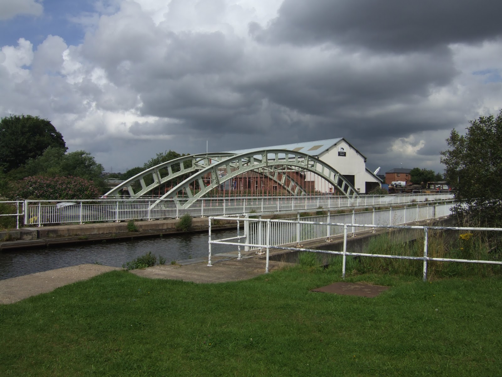
| Stanley Ferry Aqueducts |
Thankfully, walking the Navigation channel doesn't require too much thought or interaction, the following stretches are mostly very long and very straight. You start to notice that this is a popular walking spot, paths on both sides of the cut, as well as lots of pink flowers, possibly of the
impatiens genus but probably not as I know bugger all about botany. Pass under the M62 and wonder why the environs look unfamiliar until I realise that I'm thinking of where the M1 crosses the Calder & Hebble, and start to feel bored at the flatlands providing such dull landscape, where bridges for the only interruptions in the landscape. The stretch from King's Road lock to Birkwood lock, however is infested with fishermen and they are not a sociable bunch, the number who seem reluctant to move their rod poles to let a walker pass is just ridiculous, maybe two offered a hello and they went on for over half a mile too. And they have so much kit too, it must cost a lot to unsociably sit on one's arse for hours at a time! Glad to be past them, and for the next canal section to be a bit leafier, with St Peter's, in Stanley, providing an amusing bit of architecture on the horizon. Just as the swing southwards starts to get boring, we arrive at Stanley Ferry and things get interesting again, boatyard and docks would be diversion enough, as well as the large marina, but here we have the pair of aqueducts over the Calder. One of 1839 vintage in cast iron and the other from 1981 in concrete, and both 50 metres long, and acting as waste traps, along with the footbridge, and a peer below show up probably half of the plastic bottles, footballs and driftwood that washed down the Calder during its last crazy spell. Annoyingly, there are no benches around here, so I have to prop myself up against a fence to take lunch and painkillers as my head is still pounding.
 |
| Broadreach Flood Lock |
The cut beyond is mile south in a straight line, mostly moorings from Ramsdens bridge to Harrisons bridge, and then looking oddly forgotten to Broadreach bridge, largely because most folks travelling this lower section are following the more elevated path away from the water's edge. Hello again Trans-Pennine Trail link, you do enjoy tempting me with a path I don't have time to schedule yet, don't you? Broadreach lock appears to be a rise lock until you realise all the gates are open, and it's actually a flood lock, and this is the end of the Aire & Calder Navigation channel, as the river is navigable all the way to Wakefield wharf, and this is the best spot to get a look at the railway bridge carrying the Hallam line inti Wakefield, and its a two arch duplicate of the L&Y viaduct at Methley, as far as these eyes can see. No opportunity to take a closer look as the path on the south bank of the river wanders into a nature reserve and for a long section you can actually feel like you could get lost at any moment. I don't, of course, we pop out by Oakenshaw beck and meet the riverside at the site of the start the Barnsley canal, now closed and infilled but still traceable when I fancy a 14 mile stroll in that direction. Past the site of Wakefield power station and under one more railway bridge, Foundary Shoal on the Pontefract line, and then it's wander on into Wakefield, and at Fall Ing we can start on another canal, the Calder & Hebble!
 |
| Fall Ing Lock |
Fall Ing was once at the heart of Wakefield's coal distribution, but is now home to moorings and post industrial desolation, but along the Wakefield cut, redevelopment is trying to snazz it up a bit and looked like it was going well before the economy went south. Wakefield flood lock is the end of that cut, and I look on down the Calder toward the next walking day, before returning to Fall Ing via Doncaster Road (not a worthwhile diversion) to cross Fall Ing Bridge to see if anything remains of the Aire & Calder's Wakefield Wahrf, and the inlet has gone and the wharf has been built over, even though it shows up on my Explorer289, thankfully the Navigation's offices are still there. We do get to pass through Wakefield's most attractive quarter whilst finding this out, crossing Chantry Bridge with its 14th century chapel and observing the Hepworth Wakefield, a gallery which is only a year old and I knew nothing about and must be worthy of a visit when walking season ends. Homeward bound at 2.30pm to the train from Wakefield Kirkgate, and I take back my comment about Castleford being the most dilapidated station in the county, because this is one depressing place. They might be trying to renovate it, and I'm usually one to advocate the preservation of old buildings but this is one I really think they should just bulldoze the whole thing and start over again, It really is an irredeemably awful place. And in other news, the new boots performed just fine, but the headache still had another four hours to run...
1,000 Miles Cumulative Total: 297.7 miles
 New Shoes: Does anyone else do the skit of discovering that somebody has new footwear and going 'Noo Shoos! Noo Shoos!' repeatedly? I do, and have no idea why! But it's new boots day for me, and having made no attempt of any kind to break them in, let's hope they're not going to rub me up, I'd worried that they might pinch a bit when I bought them, but today they felt a bit on the roomy side, so I hope my feet don't slide all around inside them. They're as comfy as you could want though, and it's going to be nice to be able to wade through puddles and not worry about leakage, and maybe I should take good care of them too, like scrubbing them occasionally and not letting them get them all scuffed up, I might finally look like a proper walker! So, let's hit the trail and get these new All-Leather babies dirty!


No comments:
Post a Comment